When you click on links to various merchants on this site and make a purchase, this can result in this site earning a commission. Affiliate programs and affiliations include, but are not limited to, the eBay Partner Network.
Found the area. Thanks. But how do you access this? Is the the trail accessible from I70?
Yep take exit 131 and go along frontage road on the south side of the interstate for a few miles. Then turn right on 3829, that will take you back under the interstate to the start of the loop.
I was finally able to take my Defender out in the wild. Drove from Peach Springs down the to bottom of the Colorado River near the Grand Canyon via BIA-6. Nothing too rough but got her plenty dirty.
This is from last August but I haven't been on here since then. Start of Engineer's Pass just outside Ouray, CO.
@NoGaBiker , do you have the GPS coordinates for this photo, by chance? I'm currently doing my homework for the Alpine Loop trip later in the summer, and this was one of the photos that made me want to go there to begin with, but I don't see any similar terrain on Engineer Pass proper. Is this on Mineral Creek, by chance?
I was finally able to take my Defender out in the wild. Drove from Peach Springs down the to bottom of the Colorado River near the Grand Canyon via BIA-6. Nothing too rough but got her plenty dirty.
You mean, dusty?
Did you see the Three Stooges? I was told they're sort of a local celebrity. The one on the left stood there for, I swear on my memory and dashcam timestamps, about ten minutes. Finally lost interest and walked away.
I was finally able to take my Defender out in the wild. Drove from Peach Springs down the to bottom of the Colorado River near the Grand Canyon via BIA-6. Nothing too rough but got her plenty dirty.
(looking at the photos again) @D110Xd, do I see it right that this is a Carpathian Edition, wrapped?
That's a familiar place. I've been there once, thought that I posted the photos, but alas, apparently not. Lemme fix that, with a few comments.
This place is also known as Diamond Creek Beach (maps link), and getting there is a bit tricky. The least of your problems is gas, the last station on the way in is in Peach Springs. Right next to it is the Hualapai Game & Fish where you better get your permit 'cause otherwise you're in trouble - there's usually a ranger posted by the river that will check permits of everyone coming there. Beware of timing - they say "until 4PM" but 4PM is actually time by which you have to *leave* the beach, not head out.
Special note - absolutely no drones. They're very sensitive about that, and people have been known to be... I don't know the right word, caught? fined? on the spot - don't take my word for it, ask Google for horror stories about that.
Other than that - a plain dirt road which, however, can be closed after rains because all the water from surrounding mountains gathers on this road and flows down to Colorado River.
...and after the rain is exactly when you want to be there because the air gets transparent and you can see the magnificence in fine details.
Dusty indeed @Vadiable Paradox On the way back the tires got wet going through water and the dust really got caked on.
it is a Carpathian Edition (matte wrapped) V8. Very thirsty and I can�t do anything extreme with 22� wheels. It was a fun day either way.
thank you for the heads up about the drone. I was upset I didn�t bring my Mavic with me. I guess it doesn�t matter either way since we can�t have drones out there.
Yoooo @DefenderSISU you went for it! Also curious where exactly you were.
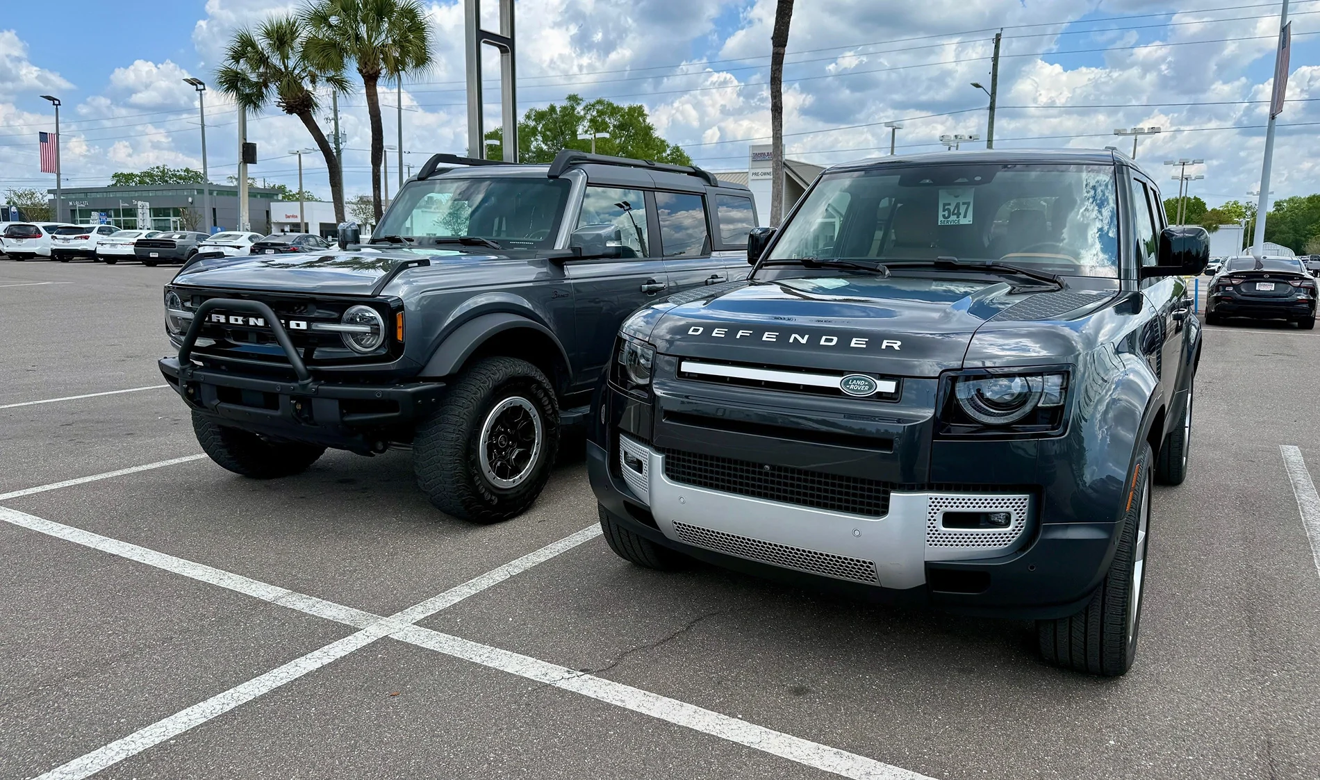
I'm new here. Just picked up a Defender 130 (primarily for the wife) end of last week.
It replaced our Bronco that spent some time mostly in Citrus county.
This is as "out in the wild" as the Defender has been so far..
How did you like the Defender compared with the 6G?
The wife and I had a Bronco Sport (hers) and a 2 door 6G, and while they were OK we both found ourselves back in the Rover world.